
Willey Range Trail (Ladder Section) - Mount Willey
TRAIL STATISTICS
Trail Distance: 1.1 miles
Trail Elevation Gain: 1,650 feet
Trail Hiking Time: 1 hour, 25 minutes
Trail Difficulty: Moderate
TOTAL HIKE STATISTICS
Total Hike Distance: 5.4 miles (with Mount Willey)
Hike Elevation Gain: 2,800 feet
Hiking Time: 4 hours, 15 minutes

Hike date: 06/09/2019
Description: The Willey Range Trail runs from the junction of Ethan Pond Trail to the junction of the A-Z Trail. The portion of the trail that lands it on the T25 elective list climbs the south slope of Mount Willey and is very steep and rough. There are a series of several ladders located halfway up the trail. You’ll also climb over Mount Field in order to do the whole trail. This trail can be one of the five elective trails needed for the patch.
Trails Used: The parking for this hike is at the end of Willey House Station Road. Ascend via Ethan Pond Trail to Willey Range Trail to the summit of Mount Willey. Descend by turning around and going back the same way you came. Alternatively, you can do a long in and out or a Willey Range Traverse if you are interested in getting Mount Field and Mount Tom too - more information can be found in the alternative routes section of the Mount Willey page here.
Trail Summary: This route is an in-and-out route to the summit of Mount Willey. The trailhead for this hike is at the end of Willey Station Road off of Route 302. It is a short road that leads to a dirt parking lot. You will first need to take the Ethan Pond Trail in order to reach the Willey Range Trail. As soon as you start out on the trail, you will cross over railroad tracks and ascend on an old logging road. The trail starts out climbing very steadily, but it will then level out and climb more gradually. After hiking for 1.6 miles, you’ll come to the junction with the Willey Range Trail. Up until this point, you have gained about 1,200 feet in elevation. Once on the Willey Range Trail, you will cross Kedron Brook almost immediately. The trail climbs moderately for now, and you will soon cross another brook. After this, a long, steep, and rough grind up to the summit begins. There are several ladders located along the steepest part of the trail to help you ascend safely. They really are not too bad unless you are afraid of heights; they are built well and the steps of the ladders are wide. After the ladders, the trail continues to climb at a steep grade over rough and rocky terrain. Eventually, you will reach the summit cairn for Mount Willey. Right below the summit and before the cairn, there is a side path that leads to a nice outlook point looking east. From the last junction to the summit of Mount Willey (the portion of the trail on the T25), you will have gone 1.1 miles and gained 1,650 feet of elevation. If you are going to include Mount Field and Mount Tom in your hike, you would continue on the Willey Range Trail from here (more on that in the alternative routes section on the Mount Willey page). Otherwise, after enjoying the summit and hopefully feeding some grey jays (this is a popular peak for that), you will return back the same way you came. The descent is rugged and rough, so some extra caution may be needed on the steeper sections. Descending on the ladders was not too challenging at all!
A NOTE ABOUT THIS TRAIL IN WINTER: We have actually attempted to summit Mount Willey from this approach in the winter but failed to do so. We made a spontaneous decision to hike this trail with our friends and didn’t bring snowshoes based on recent trail reports (huge regret). We also underestimated how intense the ladder section would be without crampons and an ice axe (which we have but did not bring). The ladder section was extremely sketchy as it was completely covered in a sheet of ice. We did make it up past the ladder section, but ultimately turned around about 0.4 miles away from the summit since there was a snow storm moving in and we did not have the right gear with us to continue on. Descending the ladder section in the winter was absolutely terrifying… We had to slide down a very steep trail and aim for the trees in order to catch ourselves. This was a good learning lesson for us: Always carry snowshoes, don’t underestimate steep trails in winter conditions, and know when to turn around! We now know that crampons and an ice axe would have been very helpful for this hike - and we will bring them with us next time!
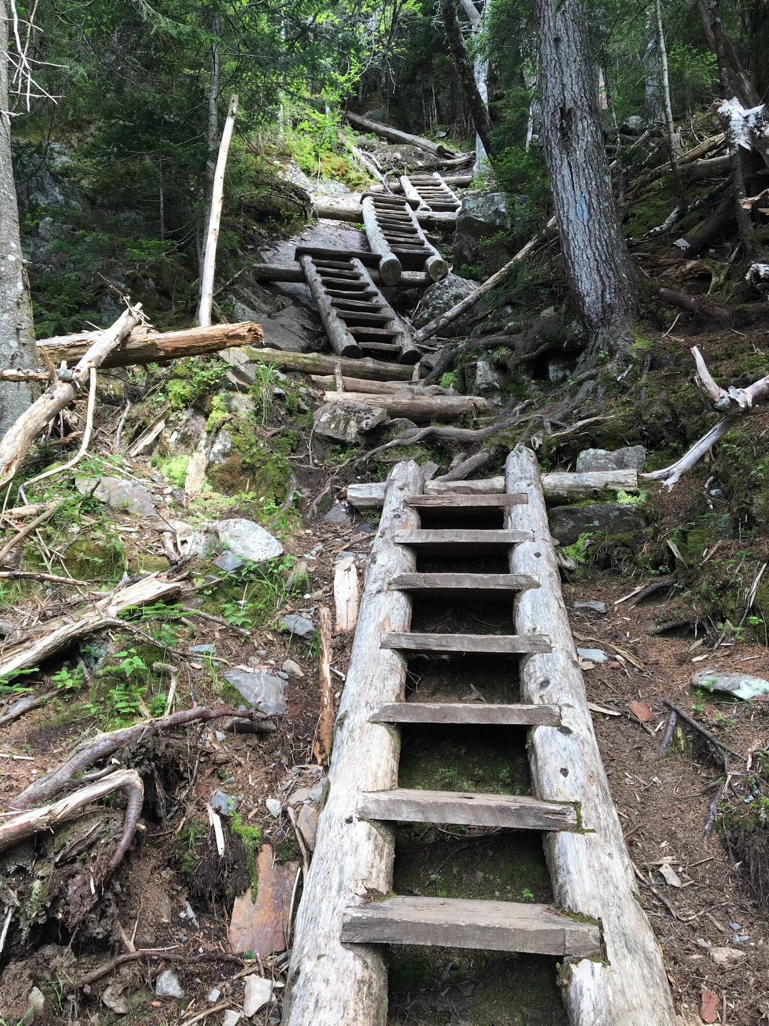
Looking up to the top of the ladders… it is steep!

Climbing up the ladders!

Looking down from the top of the ladders. Hope you aren’t afraid of heights!
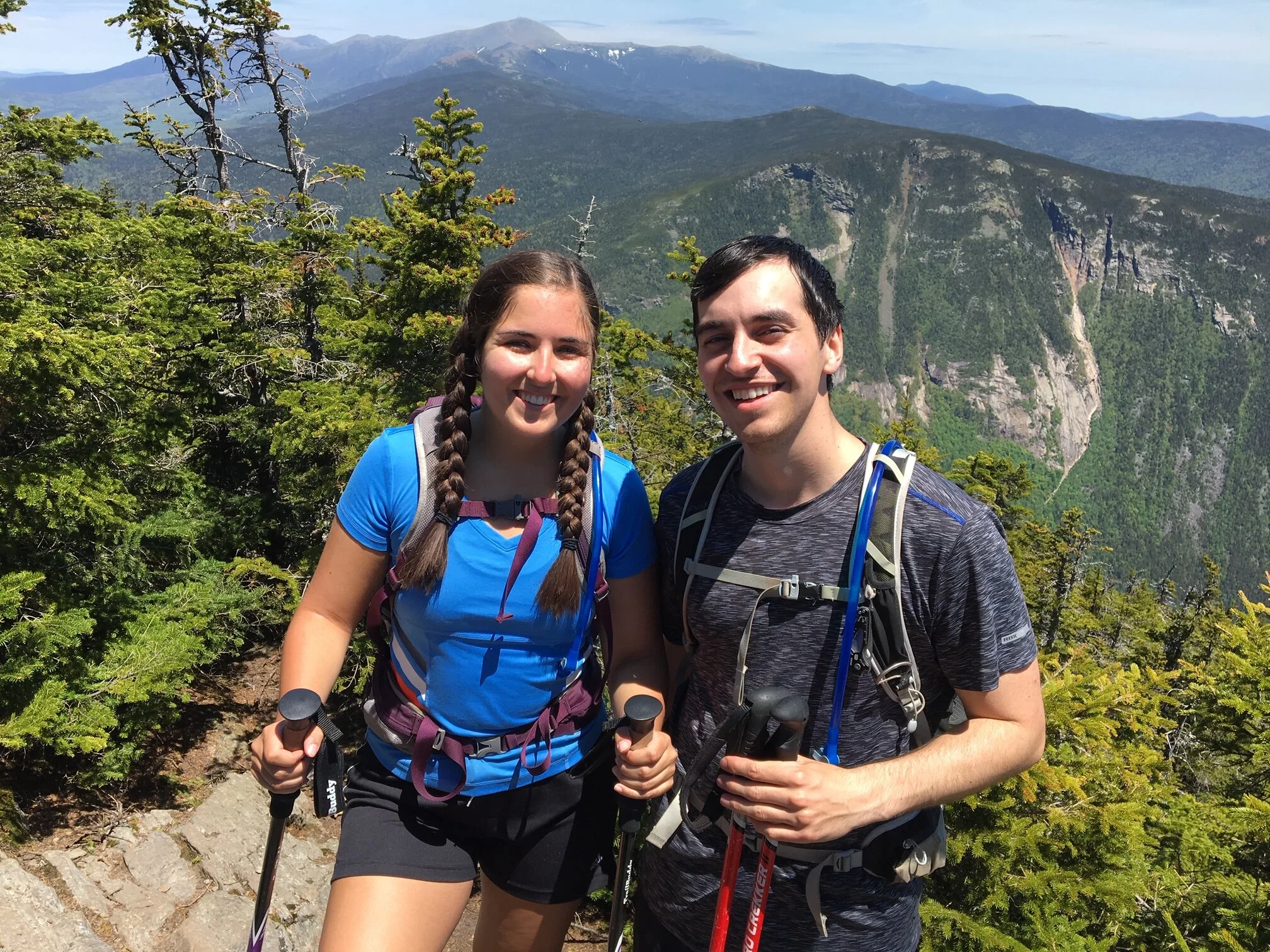
Enjoying the views from the summit of Mount Willey
Questions? Comments? Want to share your take on this hike? Get in touch with us using the contact page!


As experienced hikers, we always make sure that we are hiking with The Ten Essentials which include navigation, a headlamp, sun protection, first aid, a knife, shelter, extra food, water and clothes. Overtime, we have discovered some items that we always bring on our hikes and consider them to be our personal, expanded ten essentials.