
Mount Field - 4,340'
Hike Statistics
Total Distance: 7.6 miles (with Mount Tom); 7.2 miles (with Mount Avalon and Mount Tom); 9.8 miles (with Mount Avalon, Mount Willey, and Mount Tom)
Elevation Gain: 2,700 feet (Option 1); 2,720 feet (Option 2); 3,310 feet (Option 3)
Hiking Time: 5 hours, 15 minutes
Difficulty: Moderate
Season: Spring
Hiking this peak in winter? Click here!

Hike date: 03/29/2019
Description: Mount Field is the highest peak within the Willey Range and offers limited views of the surrounding area in Crawford Notch. We will highlight the option that summits Mount Field and Mount Tom (Option 1); we didn’t go up and over Avalon, although we probably should have included it looking back. Using the below route, you will have the opportunity to bag multiple peaks, including Mount Avalon (not a 4,000 footer, but it has great views).
Trails Used: Ascend via Avalon Trail to A-Z Trail to the junction with the Willey Range Trail. At the junction, take the Mount Tom Spur to the summit of Mount Tom then retrace your steps back to the junction. Take Willey Range Trail to the summit of Mount Field. Descend by returning the same way on Willey Range Trail back to the junction and going down A-Z Trail to Avalon Trail, the same way you came up.
Trail Summary: This route approaches Mount Tom and Mount Field (as well as Mount Avalon and Mount Willey) from the AMC Highland Center on Route 302 as an in-and-out. The trailhead parking lot is at Crawford Notch Station, just after the Highland Center. If you are here in the middle of summer, you will most likely have to park along Route 302 somewhere as this is a very busy area. The trail starts in the woods across the railroad tracks behind the Train Depot. Once you’re on the Avalon Trail, you will come to a junction in 0.1 miles with the Mount Willard Trail. Stay right on the Avalon Trail where you will start to ascend gradually and eventually cross a brook (usually easy to cross, but could be tough if the water is high!). After this crossing, you’ll come to a loop path (which is 0.1 miles long) that goes by Beecher and Pearl Cascades before rejoining the Avalon Trail. At this point, the Avalon Trail continues to climb moderately until it crosses the brook again and then continues climbing moderately. As you approach the junction with the A-Z Trail, the trail gets a bit steeper. At the A-Z Trail junction, you will continue straight, taking the A-Z Trail now. Up until this point, you have hiked 1.3 miles and gained 850 feet of elevation.
NOTE: If you want to include Mount Avalon in your hike, you would go left at this junction, staying on the Avalon Trail to the summit of Mount Avalon. This section of the Avalon Trail is a consistent steep and rocky climb all the way to the summit and to junction with the Willey Range Trail, where you can then go to Mount Field, as well as over to Mount Willey if you wish, before heading back over Mount Field to get to Mount Tom by following the Willey Range Trail.
Now on the A-Z Trail, you will reach the Willey Range Trail in 1 mile and after 1,000 feet of elevation gain. The A-Z Trail will dip slightly before starting to climb steadily. About halfway up the A-Z Trail, you will cross the brook again and then the trail will climb steeply until you come to the junction with the Mount Tom Spur. The Mount Tom Spur will take you to the summit of Mount Tom after 0.6 miles and 350 feet of elevation gain. The trail climbs at easy grades with only one steep and rocky section until you come to an area that you may think is the summit. Look for a small side path on your right that will take you to an area with limited views. Continue on the main path and you will find the summit nearby.

Sign marking the start of the Avalon Trail behind the railroad tracks

Enjoying our early spring hike along the Avalon Trail
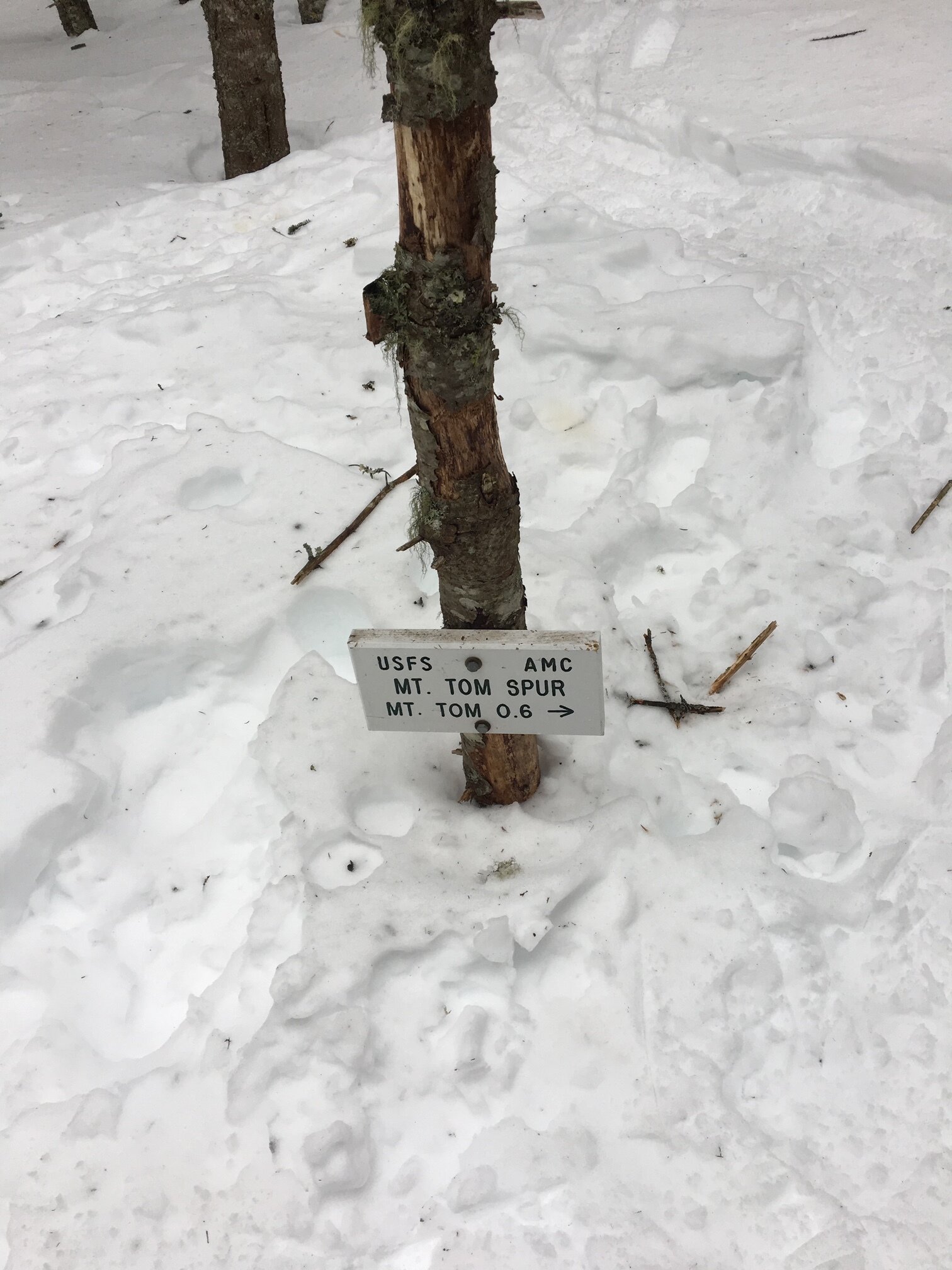
This sign is usually 5 feet off the ground! Lots of snow still left

The summit of Mount Tom

With the snow on the ground, the view from Mount Tom is much better than in the summer time!

Summit selfie!
After enjoying the summit of Mount Tom, retrace your steps down the Mount Tom Spur back to the A-Z Trail. Once back on the A-Z Trail, continue for about 100 yards until you come to the Willey Range Trail junction. Take a left here to hike along the Willey Range Trail to Mount Field. The trail ascends very gradually until you come to the junction with the Avalon Trail (this is where you would come out if you went over Mount Avalon). From this junction, it’s 100 yards on a quick but steep pitch to the summit of Mount Field. You’ll come to a clearing with a cairn marking the summit of Mount Field. There is a short side path here that will lead to an outlook with decent views.
NOTE: At this point, you have the option to go over to Mount Willey to get another 4,000 footer. If you do, it will be 1.4 miles to the summit. The portion of the Willey Range Trail coming off of Mount Field descends moderately for the most part, with some steep sections, until you reach the col. From the col, you will climb gradually towards the summit of Mount Willey. After enjoying the summit, retrace your steps and take the Willey Range Trail back to Mount Field.
After enjoying Mount Field, it is time to descend. You will follow the Willey Range Trail back to the A-Z Trail, and descend the same way you came (taking A-Z Trail to Avalon Trail to the trailhead). This descent is moderate most of the times and has some good butt sliding sections to add some fun!

Trail signs are pretty much buried in late March!

Summit selfie on Mount Field

Views from the outlook on Mount Field
Alternative routes:
One option to get Mount Willey, Field, and Tom is the Willey Range Traverse. This hike starts at Willey Station Road, where you will take Ethan Pond Trail to the Willey Range Trail. Then take the Willey Range Trail to Mount Willey (this involves taking the ladder route - more info here). From Mount Willey, you continue up and over Mount Field. After Mount Field, you will take Willey Range Trail to the A-Z Trail, where you can then take Mount Tom Spur to the summit of Mount Tom. To descend, take the A-Z Trail down to the Avalon Trail to the trailhead at the Depot near the Highland Center. This route will require two cars or hitching a ride at the start/end of your hike. Hike Stats: 8.5 miles — 3,425 feet of elevation gain — Around 6 hours
Another option to get Mount Willey, Field, and Tom is the Willey Range Traverse as an in and out. This is the same as the above route, except after Mount Tom you would retrace your steps all the way back over Mount Willey and back down to your car. This is a long, brutal route, but it is good for people looking for a challenge or those not comfortable hitching a ride / don’t have a second car spot. Hike Stats: 11.2 miles — 4,285 feet of elevation gain — Around 8 hours
Hiking Mount Field in the winter

We have not yet climbed Mount Field in the winter, but once we do, we will update this page with our full report!
Questions? Comments? Want to share your take on this hike? Get in touch with us using the contact page!


As experienced hikers, we always make sure that we are hiking with The Ten Essentials which include navigation, a headlamp, sun protection, first aid, a knife, shelter, extra food, water and clothes. Overtime, we have discovered some items that we always bring on our hikes and consider them to be our personal, expanded ten essentials.