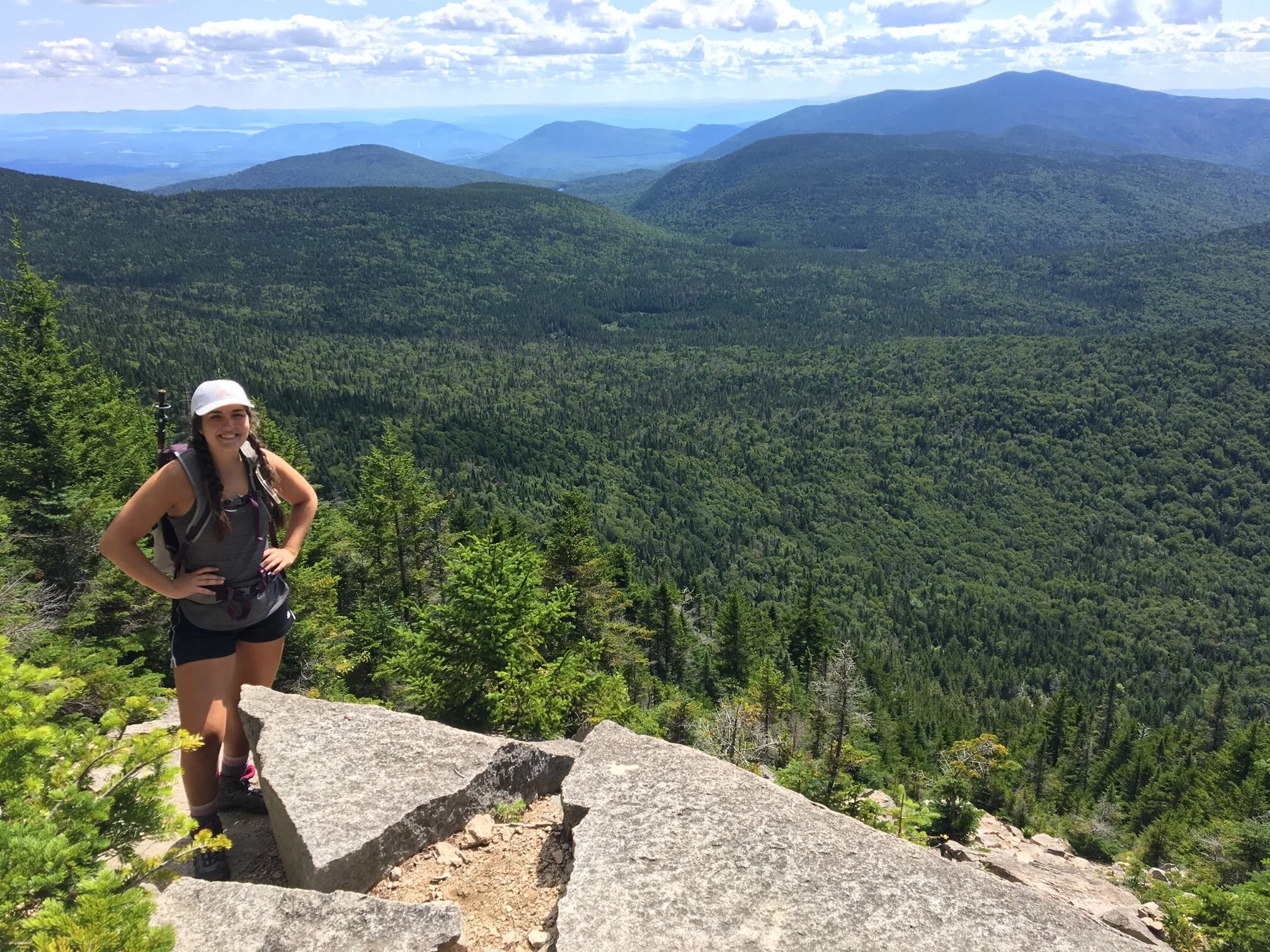
The Terrifying 25
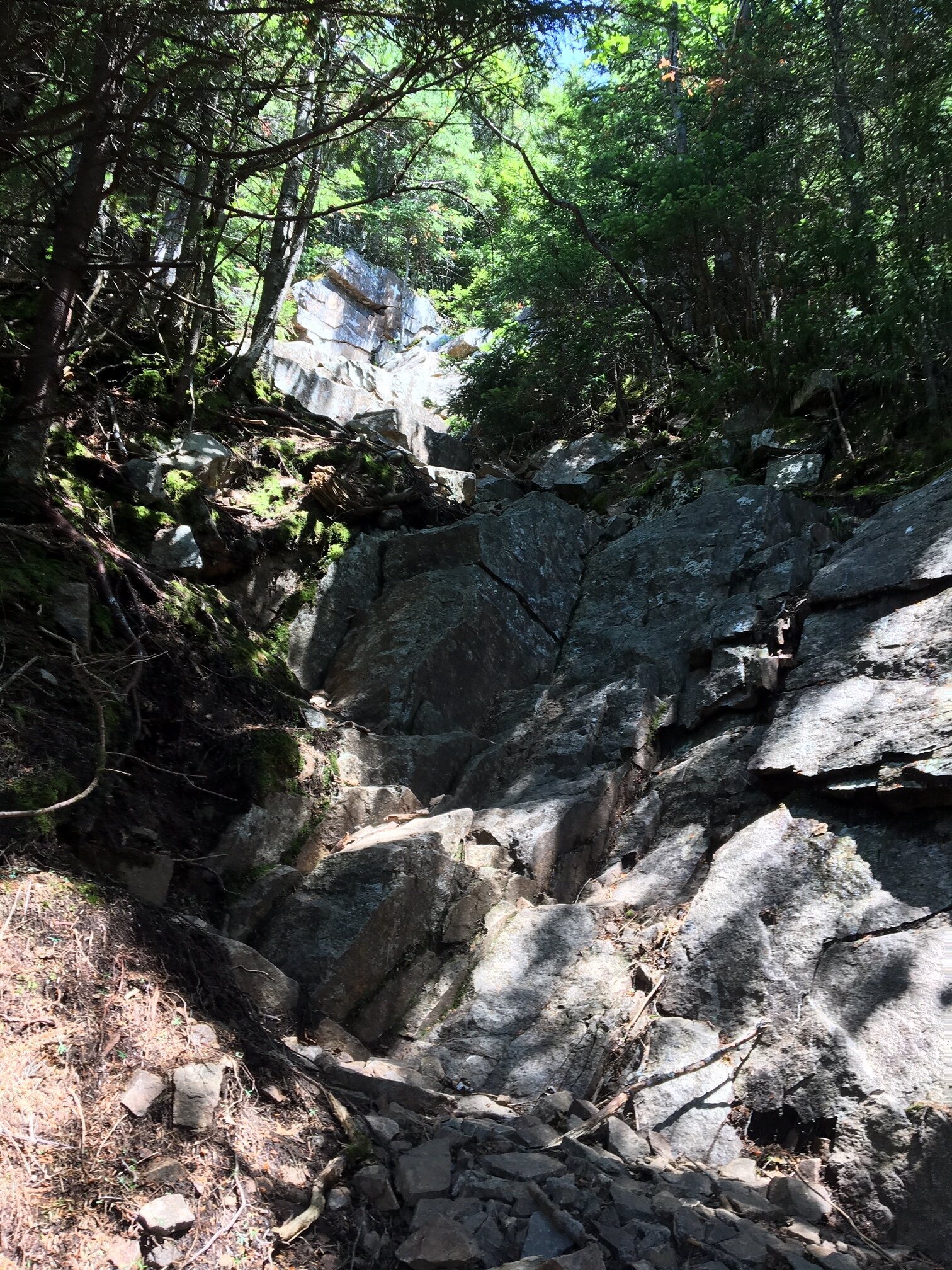
The Terrifying 25 list (commonly referred to as the T25) includes trails in the White Mountains of New Hampshire that have slides, rock scrambles, and boulder caves. These are trails that are very rugged, sketchy in places, and usually very dangerous in bad weather. It is certainly a great list for hikers seeking a bit of an adrenaline rush while they hike.
To complete this list and earn yourself a totally awesome patch, you have to hike the 20 required trails (noted below) as well as any 5 trails from the electives list (also noted below). Note that you must hike the ENTIRE length of each trail for it to count. Some of these trails are rather tame, while others are very difficult and physically challenging.
The Terrifying 25 Progress: Adam and Emily are both at 10/25

1. BALDFACE CIRCLE TRAIL - REQUIRED
This trail loops over North and South Baldface and has about 4 miles of open ledges with great exposure and excellent views.

2. CAPS RIDGE TRAIL - REQUIRED
This trail makes a direct ascent to the summit of Mount Jefferson. The trail is steep and rough with numerous ledges that will require rock scrambling. You are also very exposed to the weather.

3. CARTER LEDGE TRAIL - REQUIRED
This trail climbs to Middle Sister and offers views of Mount Chocorua. There are many ledges to cross and a few fun rock scrambles along the way.

4. CASTLE TRAIL - REQUIRED
This trail climbs to the summit of Mount Jefferson and offers incredible views along the way. The portion that traverses the Castles is very rough and has some difficult rock scrambles.

5. CHEMIN DES DAMES - REQUIRED
This trail goes from King Ravine and connects to the Air Line trail below the summit of Mount Adams. The terrain is very steep and rough; you will climb 800 feet in just 0.4 miles!
6. FLUME SLIDE TRAIL - REQUIRED
This trail will take you to the Franconia Ridge Trail right below the summit of Mount Flume. The upper section of this trail is extremely rough and steep. There are numerous smooth rock slabs that are usually wet and slippery.

7. GREAT GULF TRAIL - REQUIRED
This trail climbs a very steep and rough headwall to put you about 0.5 miles away from the summit of Mount Washington. You’ll climb 1,600 feet in 0.8 miles over lots of loose rock as you climb up the headwall.

8. GREAT GULLY TRAIL - REQUIRED
This trail offers a very scenic route to climb from King Ravine to Gulfside Trail at Thunderstorm Junction below the summit of Mount Adams. This route is extremely steep and rough, and extra attention is needed to make sure you don’t lose the trail.

9. HUNTINGTON RAVINE TRAIL - REQUIRED
This is known as the most difficult hiking trail in the White Mountains and is not to be taken lightly. It should only be attempted under excellent weather conditions. There are several ledges that require precise use of your hands and feet in order to ensure your safety. Extreme caution at all times is essential. The exposure on the very steep ledges is enough to rattle even the most experienced hikers.

10. ICE GULCH PATH - REQUIRED
This trail takes you through Ice Gulch, an area that will require you to constantly scramble over wet and slippery rocks, a lot of which have deep holes in between them.

11. KING RAVINE TRAIL - REQUIRED
This trail climbs a headwall and takes you to the top of King Ravine below the summit of Mount Adams. The headwall section is very steep and rough, but the views from this trail are unparalleled.

12. MADISON GULF TRAIL - REQUIRED
This trail goes from the Mount Washington Auto Road and ends near the Madison Springs Hut below the summit of Mount Madison. The trail climbs one of the most difficult headwalls in the White Mountains. You will be hiking over several steep slabs and ledges, scrambling over boulders, and climbing a big rock chimney.

13. MOUNT MORGAN TRAIL (LADDER ROUTE) - REQUIRED
This trail leads you to the summit of Mount Morgan. There is one portion of the trail where you will ascend three ladders, climb through a boulder cave, and scramble over some steep ledges to a viewpoint.

14. MOUNT PERCIVAL TRAIL (BOULDER CAVE ROUTE) - REQUIRED
This trail leads you to the summit of Mount Percival. The boulder cave portion of the trail takes a difficult and strenuous route through a boulder cave and then up a series of ledges to the summit.

15. NORTH SLIDE, NORTH TRIPYRAMID - REQUIRED
The North Slide is a part of the Mt. Tripyramid Trail and offers a difficult ascent to the summit of North Tripyramid. The lower portion of the slide has many steep and difficult rock slabs that are usually wet and slippery, while the upper portion is more exposed and climbs rough, but dry, rocks.

16. SIX HUSBANDS TRAIL - REQUIRED
This trail will lead you a short distance away from the summit of Mount Jefferson. The trail leaves from the Great Gulf Trail and climbs very steeply towards the summit over very rough terrain. You can expect lots of boulders, ladders, and scary ledges on this trail.

17. SOUTH SLIDE, SOUTH TRIPYRAMID - REQUIRED
The South Slide is a part of the Mt. Tripyramid Trail and offers a difficult descend from the summit of South Tripyramid. The slide consists of loose gravel and rocks at a steep angle, so footing can be very tricky.

18. SPHINX TRAIL - REQUIRED
This trail runs from the Great Gulf Trail up to the Gulfside Trail in Sphinx Col, right near the summit of Mount Jefferson. Expect a very steep ascent, with sections where you’ll be climbing over slippery rocks and scrambling across tricky ledges.

19. SUBWAY (KING RAVINE TRAIL) - REQUIRED
The Subway is a short alternative route on the King Ravine Trail (which you can learn more about above). This side path is more interesting, yet more difficult, than the main trail as you’ll weave through boulder caves making your way over and under massive rocks.

20. TABLE ROCK TRAIL (DIXVILLE NOTCH) - REQUIRED
This short (and rough) loop path takes you to Table Rock, a narrow ledge with sheer drops from its cliff face. From the east trailhead, this trail climbs very steeply, gaining 600 feet in 0.3 miles with rough and slippery footing.

21. airline trail - elective
This trail is the shortest route to the summit of Mount Adams from a trailhead. The middle section of the trail is steep and rough, and the section above treeline is very exposed to the weather as you climb over large angled stones. This trail can be one of the five elective trails needed for the patch.

22. algonquin trail - elective
This trail will take you to the top of Sandwich Dome and affords many nice views from the open ledges. The trail is steep and rough at times, with one particularly challenging rock scramble. The ledges can be slippery if they are wet. This trail can be one of the five elective trails needed for the patch.

23. beaver brook trail - elective
This trails leads you to the summit of Mount Moosilauke and passes the Beaver Brook Cascades. The section of the trail along the Cascades is very steep and rough, and dangerous in wet or icy conditions. There are many rock steps, wood steps, and iron rungs to aid you on your ascent. This trail can be one of the five elective trails needed for the patch.

24. brook trail - elective
This trail runs to the junction with the Liberty Trail just below the summit of Mount Chocorua. Higher up on the trail, expect to ascend steep ledges. Though more difficult than the Liberty Trail, you’ll have a much more scenic experience filled with excellent views. This trail can be one of the five elective trails needed for the patch.

25. blueberry ledge trail - elective
The Blueberry Ledge Trail offers a very scenic route to the summit of Mount Whiteface, though the upper portion of the trail is steep and rough, requiring some rock scrambling. Be ready for some steep ledges and nice outlooks! This trail can be one of the five elective trails needed for the patch.

26. castle ravine trail - elective
This trail runs from Israel Ridge Path to Randolph Path near Edmands Col (below the summit of Mount Jefferson). Hiking through Castle Ravine offers a scenic experience, though parts of the trail are really rough, especially when crossing the talus section of the headwall which has poor footing. This trail can be one of the five elective trails needed for the patch.

27. desolation trail - elective
This trail ascends to the summit of Mount Carrigain. The upper part of the trail is very steep and rough. This trail can be one of the five elective trails needed for the patch.

28. Devil’s Hopyard - elective
This trail takes you through a gorge with walls that are cliffs and a floor that consists of boulders everywhere. This trail can be one of the five elective trails needed for the patch.

29. goodrich rock trail - elective
This trail will take you to Goodrich Rock, a huge glacial rock that you can climb to the top of via a ladder. Portions of the trail are rough as you’ll navigate through boulders. This trail can be one of the five elective trails needed for the patch.

30. hi-cannon trail - elective
The Hi-Cannon Trail becomes very steep and rough on its upper portion. You will have to climb a ladder in order to get on top of a steep ledge. There are several very nice viewpoints along this trail. This trail can be one of the five elective trails needed for the patch.

31. osseo trail - elective
This trail will lead you right below the summit of Mount Flume. You can expect many switchbacks and several wooden stairs. This trail can be one of the five elective trails needed for the patch.

32. percy peaks trail - elective
This trail will lead you to the summit of North Percy Peak and will bring you lots of scenic opportunities as you make your way over the slab on the upper portion of the trail. This trail can be one of the five elective trails needed for the patch.

33. wildcat ridge trail (from route 16 to Wildcat e Peak) - elective
The Wildcat Ridge Trail (to E Peak) is very steep and rough, with many sections that make it difficult and time consuming. You will climb rock steps, ladders, and wood steps while doing plenty of rock scrambling! This trail can be one of the five elective trails needed for the patch.

34. Willey range trail - elective
The Willey Range Trail runs from the junction of Ethan Pond Trail to the junction of the A-Z Trail. The portion of the trail that lands it on the T25 elective list climbs the south slope of Mount Willey and is very steep and rough. There are a series of several ladders located halfway up the trail. You’ll also climb over Mount Field in order to do the whole trail. This trail can be one of the five elective trails needed for the patch.


As experienced hikers, we always make sure that we are hiking with The Ten Essentials which include navigation, a headlamp, sun protection, first aid, a knife, shelter, extra food, water and clothes. Overtime, we have discovered some items that we always bring on our hikes and consider them to be our personal, expanded ten essentials.