Wildcat A - 4,422'
Hike Statistics
Total Distance: 9.1 miles (with Wildcat D)
Elevation Gain: 3,100 feet
Hiking Time: 7 hours
Difficulty: Moderate
Season: Fall (yes, all that snow, but it was still technically fall based on the hike date)
Hiking this peak in winter? Click here!

Hike date: 12/01/2018
Description: Wildcat Mountain, A Peak is located in the Carter-Moriah Range and offers a close-up view of Carter Notch and Carter Dome from its summit. Using the route below, you’ll have the opportunity to hike up a ski trail, check out Wildcat Ski Area, hike over multiple peaks, enjoy excellent views from many viewpoints, and make an optional stop at the Carter Notch Hut.
Trails Used: Ascend via the Polecat Ski Trails to Wildcat Ridge Trail. Take the Wildcat Ridge Trail over Wildcat D, C, B, and A (only A and D count for the list) and down into Carter Notch. Once in Carter Notch, descend via Nineteen Mile Brook Trail.
Trail Summary: The hike we will describe starts out at the Wildcat Ski Area off Route 16. Note that if you do this, you will need a second car at the ending trailhead or you can hitchhike (which is what we did and easy to do). Hikers have two options to get to the first peak, Wildcat D. The first is to take the Wildcat Ridge Trail from the trailhead across from Glen Ellis Falls. The other option is to hike up the ski trails. Since we did this hike in December, we chose to hike up the ski trails. The section of the Wildcat Ridge Trail from Glen Ellis Falls is very steep and there are several sketchy parts on it, making it very dangerous, especially in the snow/ice. More specific details and photos on this section of the Wildcat Ridge Trail can be found here. The ski trails provide a nice moderate climb up to the summit of Wildcat D. Note that you will need to buy an uphill access pass (for $10) from the lodge (if you’re hiking during ski season). You should also wear snowshoes when going up the ski trails! Uphill hikers are required to hike up the Polecat ski trails during winter. The route is as follows: Lower Polecat to Middle Polecat to Upper Polecat. A map of the ski trails can be found here. The ski trail route climbs 2,100 feet in 2.7 miles and takes you to the top of the ski mountain. From the top of the ski mountain (near where the chairlift drops skiers off), it is a quick jaunt to the summit of Wildcat D. It is a short walk, but it is a steady grade. When you reach the top, you will be at an observation tower that offers amazing 360-degree views and looks towards the Presidential Range. One peak down!

Arriving at the top of the Polecat Ski Trails

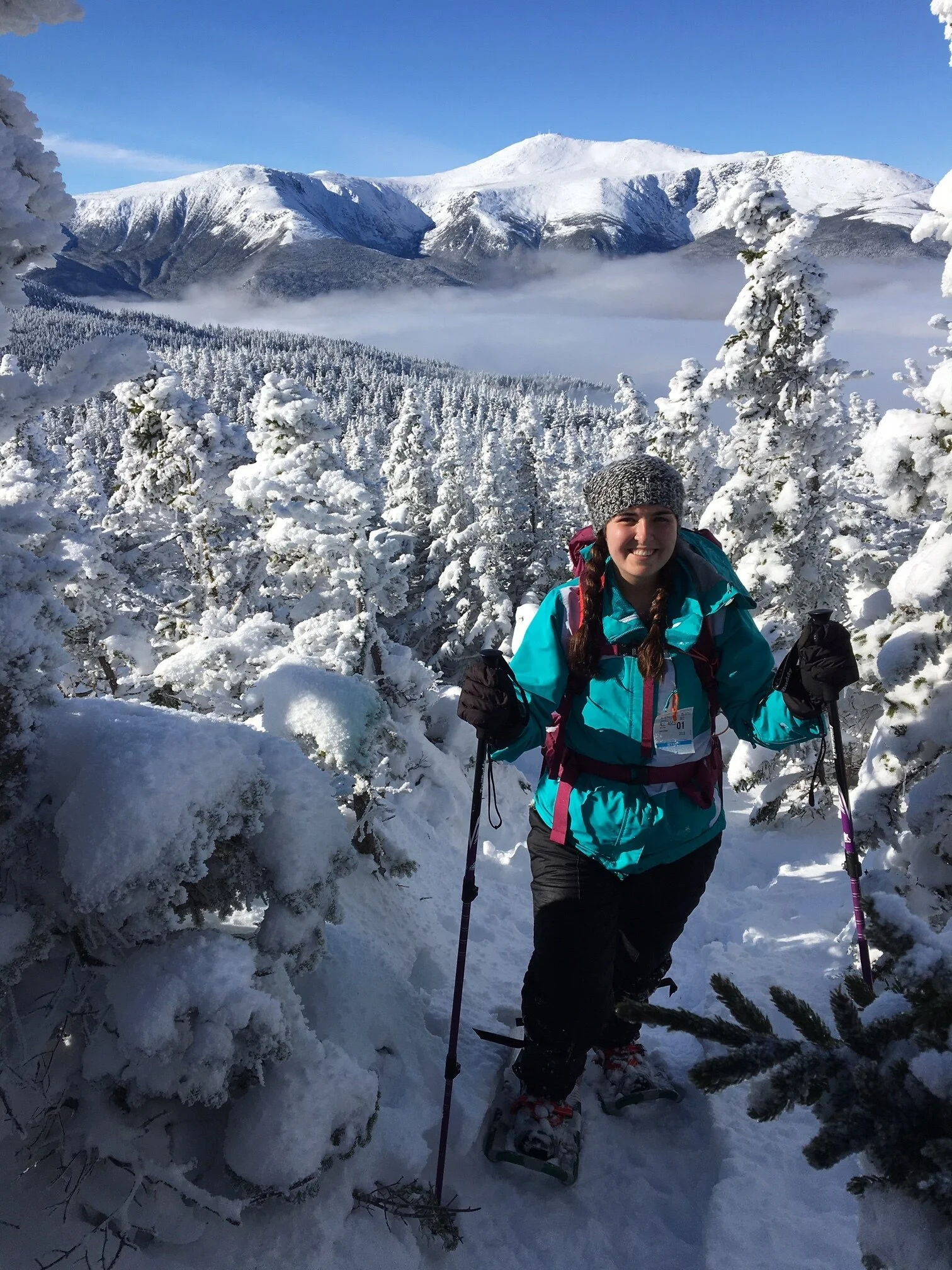
Crystal clear skies with beautiful views of the Presidential Range and some undercast!

Snow-capped Presidential Range with Mount Washington in the middle
After enjoying the phenomenal views from the tower, it’s time to hike across the Wildcat Ridge Trail to get to Wildcat A. This is an exhausting route as you actually have to go over Wildcat C and Wildcat B before finally getting to Wildcat A - there is lots of up and down. This makes the route much more challenging and time-consuming than you may think. After enjoying the views, you will descend Wildcat D at a fairly steep grade. The col in between D and C is the deepest, so expect lots of elevation loss. The trail up to Wildcat C also climbs steeply to the summit, which is wooded. From Wildcat C, you will descend deep into another col at moderate-to-steep grades, before climbing up to Wildcat B. After Wildcat B, you will descend moderately to yet another col before climbing moderately to Wildcat A. There is a small spur path near the summit that leads to a lookout point where you can see into Carter Notch (sorry, no picture of the view below! We were so tired from breaking trail that we looked at the view for a minute then kept moving. We will update once we hike these again!). From Wildcat A, the descent into Carter Notch is extremely steep and rough. This section of trail drops over 1,100 feet in just 0.7 miles! There are numerous switchbacks, which are helpful for descending. Eventually, you will come to the junction with the Nineteen Mile Brook Trail. Here you can take a short detour to the Carter Notch Hut (0.2 miles away and open year round) if you want to warm up and take a break. From the Nineteen Mile Brook junction, it is 3.6 miles back to the road. You will descend roughly 1,800 feet during this time. This trail offers a very moderate descent, especially when snow is on the ground! We were able to fly down this trail and did not have to work too hard, which was nice after dealing with the Wildcat Ridge Trail. Once we got back to the trailhead, we were lucky enough to catch a ride back to the Wildcat Ski Area (which is ~10 minutes down the road) from some friendly hikers since we did not have a second car with us.

Excellent view from along the Wildcat Ridge Trail while heading up to Wildcat A Peak

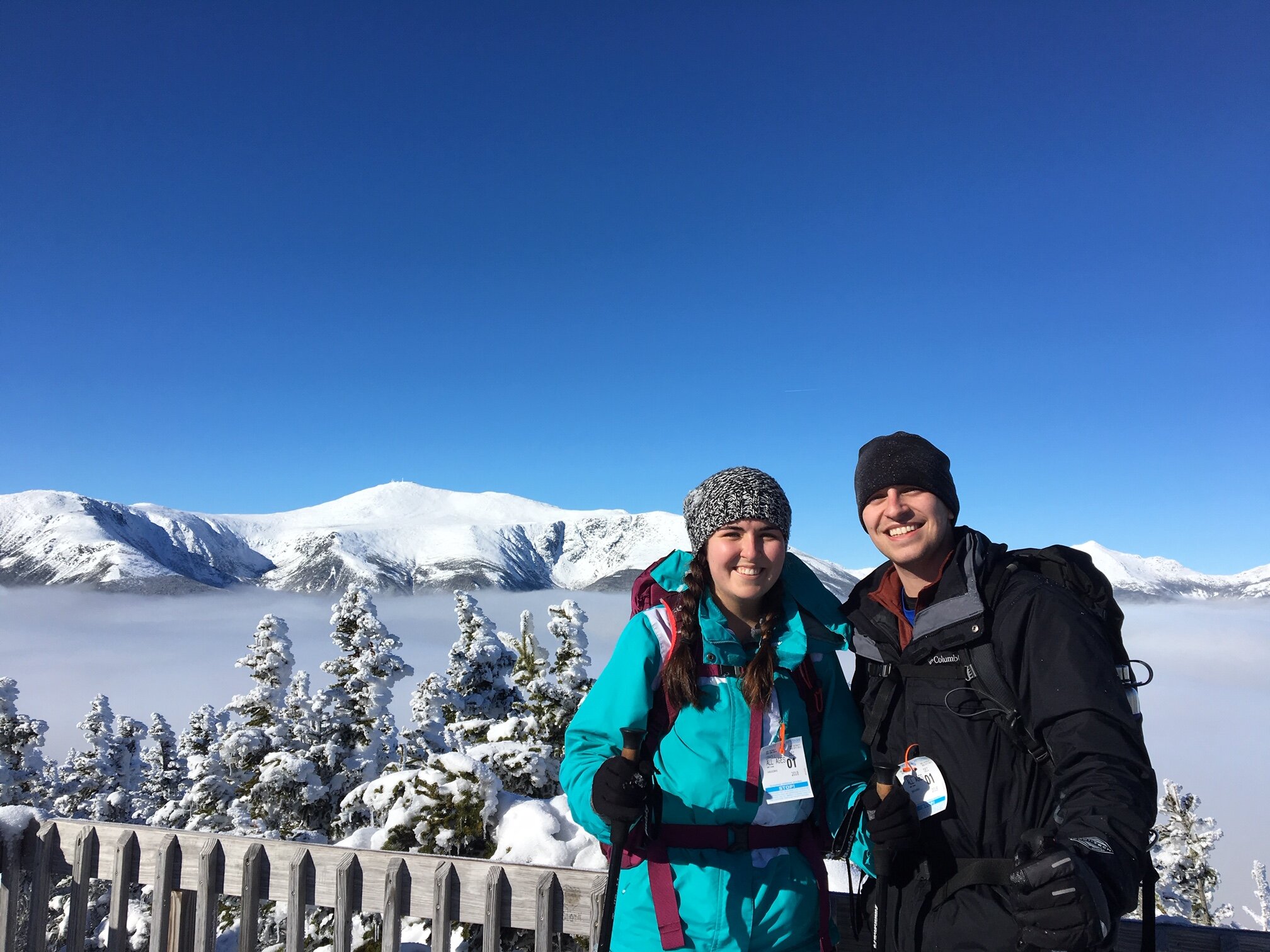
Tired, cold, and exhausted, but still loving the hike!
Alternative routes:
We have not yet done any alternative routes to the summit of Wildcat A. This page will be updated once we have!
Hiking Wildcat A in the winter
Climbing the Wildcats in the winter makes for an excellent trip! The route we described above is the ideal way to do both Wildcats in winter. As mentioned, the Wildcat Ridge Trail to E Peak is very tricky, especially in winter. There is a lot of ice and the trail is very steep. We have heard from people who have had some close calls on that section of the trail during the winter due to slips. If you are going to ascend this way, bring snowshoes, crampons, and an ice ax with you. It makes a lot more sense to take the more moderate approach by ascending the Polecat ski trails (here’s a link to the map). Just make sure to wear snowshoes on the ski trails!
The above trail summary describes hiking the Wildcats in winter. You could do this trail as an in and out from either the Wildcat Ski Area or from Nineteen Mile Brook Trail, but the elevation gain and loss on the ridge will be exhausting. The descents into the cols in between the peaks make for some really great butt sliding! When we did this hike, snowshoes were essential as it had recently snowed and the trails were not very well packed. Just make sure to either have a second car with you, or be ready to hitchhike before/after starting your hike. Route 16 is a busy road, so you shouldn’t have issues grabbing a ride!


Questions? Comments? Want to share your take on this hike? Get in touch with us using the contact page!


As experienced hikers, we always make sure that we are hiking with The Ten Essentials which include navigation, a headlamp, sun protection, first aid, a knife, shelter, extra food, water and clothes. Overtime, we have discovered some items that we always bring on our hikes and consider them to be our personal, expanded ten essentials.